


 129 / 214

Improving Transnational Transport Corridors
In the OIC Member Countries: Concepts and Cases
115
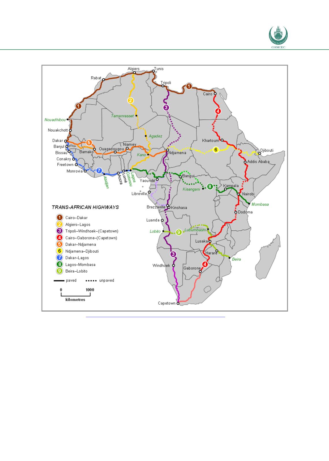
Figure 41: Trans African Highways Network UNECA
Source: UNECA an
d https://en.wikipedia.org/wiki/Trans-African_Highway_network .Spatial Analysis
A spatial analysis was carried out to show all potential transport corridor of the TAH1 and how
it fits into the overall geography of North Africa. The GIS mapping shows that TAH1 passes
through almost all the important economic centers of activity of each country. The analysis
revealed that TAH1 does not only consist of the direct road itself but also junctions and feeder
roads to. When including these additional infrastructure components TAH1 may be said to
consist of 9,712 km of roads. It is also to be noted that 569 km of the TAH1 remains to be
paved in Mauritania/Western Sahara.